Grande Semaine d'Aviation de Cannes
Cannes, France, March 27th - April 5th, 1910
Cannes, France, March 27th - April 5th, 1910
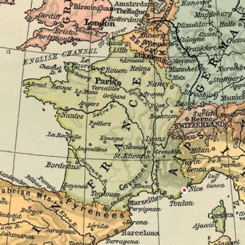
The Cannes/La Napoule airfield
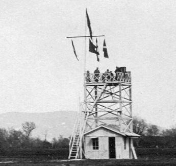
The time-keepers' pavilion and the signalling
mast. (1)
The marshy parts had been drained by means of several kilometres of drain pipes, the trees cut down and the low points filled with thousands of cubic meters of earth transported in from the neighbourhood. The little stream La Théoulière, which crossed the field, was covered by boards over its entire length. The work, which was financed by a 40,000 francs grant from the City Council, was carried out, within budget limits, under the leadership of Léon Spinabelli. The restaurant was operated by M. Navello of the "London-House" restaurant in Nice. Those who wanted a simpler meal could buy a picknick lunch from the "buffet populaire", which was ran by MM. Robin and Gaziello from the "Eldorado" and Pierrugues and Giraudy from the "Pavillon des Sports".
The French Wright licensees Ariel used the field for their flying schools already from April 1909.
For the races, an oval course with a width of 100 metres had been marked up. Its length was given as 2,327 metres, but when checking on maps it is obvious that this must be the outer periphery. The inner periphery was around 1.75 kilometres.
Today there is no trace left of the airfield. A large part of it is actually under water, covered by the huge Cannes Marina complex, which has a capacity of more than 1,700 boats.
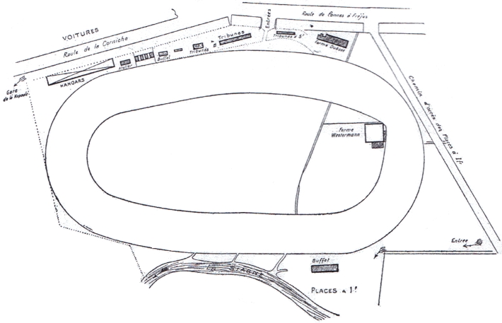
The plan of the airfield from one of the meeting
programs. North is at around two o'clock.

A superb shot of Molon flying over the southern end of
the line of hangars with the Massif de l'Estérel in
the background. From the left to the right it's the
hangars of Sands, Edmond, Frey, Crochon, Rigal and
Gaubert. (2)
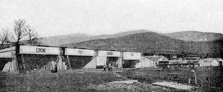
The line of hangars seen from the south. Although still
without race number, Edmond's Farman can be
recognized by the monoplane rudder and long-span
elevator. (3)
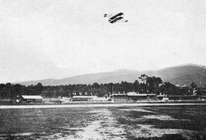
Van Riemsdijk in his Curtiss above the three
grandstands. The building to the left is the buffet.
(4)
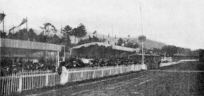
A close-up of the grandstands. The finish line and one
of its marker pylons can be seen at the right. (3)
Too see more details, open the maps in Google Maps by
clicking the "full screen" symbol at the top
right of the menu bar!
 Back to the top of the page
