Grosse Münchener Flugwoche
Puchheim, Germany, May 22nd - 26th, 1910
Puchheim, Germany, May 22nd - 26th, 1910
The Puchheim airfield
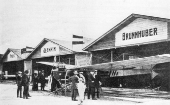
Brunnhuber's Antoinette in front of the hangars. (1)
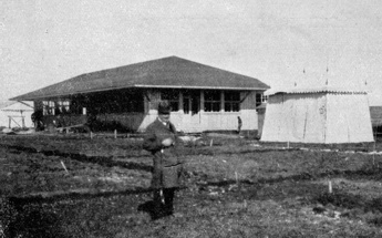
The airfield restaurant. (2)
The airfield installations were constructed by the building company "Gebrüder Rank", which still exists. It had a seven-pylon two-kilometre race course and all the installations that an airfield in 1910 needed: eight hangars, workshops, administration buildings, a restaurant with ice cellar, a canteen, several kiosks and small shops for flowers, tobacco, newspapers etc., a darkroom and a post and telegraph office.
The costs of building the airfield and arranging two aviation meetings during 1910 had been enormous for a group of "gentleman flyers, idealists and artists", and on top came persistent claims for damages from neighbouring landowners whose crops were destroyed by people who watched the flying from outside the field. In March 1911 it was decided to liquidate the academy, but the decision was eventually reversed and the society was refinanced. Three further aviation meetings were arranged in 1911 and 1912 and in 1913 a display of the famous Adolphe Pégoud attracted enormous crowds. The survival of the airfield was temporarily ensured in March 1913 when Gustav Otto leased it for running a flying school and later started the Otto-Werke for building airplanes.
At the outbreak of World War 1 the military authorities confiscated Otto's machines, and since the military decided to focus its activities on the two other airfields of Munich the airfield was doomed. In October 1914 it was decided to use the airfield as a camp for prisoners of war, partly in the hope that their labour could be used for draining the area and make it more useful for farming and developing. In 1915 the academy sold its grounds to the Bavarian State. By then the Otto-Werke and Gustav Otto's flying school had gone bankrupt. At the end of the war almost 25,000 prisoners, mainly Russian and French, lived in the around 40 barracks that had been built. The last of them were only repatriated in 1921.
The buildings were then demolished and the remains of the airfield fell into neglect, partly used for farming. During World War 2 the field was partly cleared and "decorated" for use as a decoy airfield to avoid attacks on the Luftwaffe airfield in nearby Fürstenfeldbruck. The airfield area is today used for farming and housing.
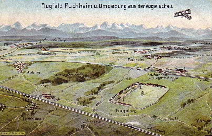
A somewhat idealized and not entirely accurate bird's eye view
from a contemporary postcard. (3)
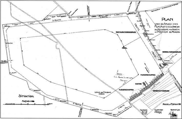
A February 1910 map of the airfield - north is at nine o'clock.
On this plan the length of the course is given as 2,250 metres. (1)
Click here for a high-resolution version!
Click
 here for a high-resolution version!
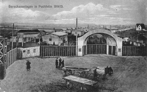
The airfield's main entrance at the southern corner of the field was unchanged after the conversion to prisoner-of-war camp, but behind it the lines of baracks extended for several hundred metres. (4)
Too see more details, open the map in Google Maps by clicking the
"full screen" symbol at the top right of the menu bar!
